The Physical Background
Folks in Shelford and those parts - Have twisted lips and twisted hearts
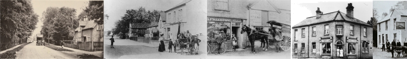
Rupert Brooke's malicious jest has brought a vicarious fame to the village. Shelford, the place name, is as familiar to thousands of readers of poetry as the place itself is unfamiliar and indeed unknown. Today the villages of Trumpington, Great Shelford and Stapleford jostle each other in one long residential ribbon. It is difficult to tell where one ends and the other begins. Motorists scurrying north to Cambridge, four miles from Shelford, or south to London, 50 miles away, are excusably confused at times. But the ribbondevelopment is not the whole of Shelford , for the parish of Great Shelford extends considerably to both sides of the A 130. The heart of the village hides itself from the main arterial road. The larger Victorian and Edwardian villas contrasting with smaller dwellings are the most noticeable feature to even the interested motorist. On the east side of the main road more modern estates and groups of houses are found. Farther on, the Shelford fields climb up the chalk slopes towards the Gogs for there is in fact a considerable amount of agricultural land within the parish.
To grasp the true nature of the parish of Great Shelford it is essential to find a high vantage point from which to survey the whole scene. A spot on the A 604 just south of Wandlebury serves this purpose admirably. The key to the understanding of the physical development of the whole area is at once apparent. From the north- east edge of Great Shelford parish, along Wort's Causeway, the land slopes gently south to the A 604 and then rises sharply to a long N. W. projecting promontory known as White Hill and Clark's Hill. Beyond this ridge the land falls to the River Cam and the summer chequerboard of green and yellow fades into the dark green of trees along its river banks. On the far side of the river the land rises gently again to the east side of Little Shelford parish.
If we now walk across this area we can see something of the underlying rocks which influence the existing landscape. The chalk ridge of White Hill and Clark's Hill as well as the Gogs themselves shine white when ploughed because they are composed of a particularly light coloured chalk rock, the Middle Chalk. Having crossed the ridge the observant walker will note that the white sheen of the soil disappears and is replaced by a darker earth, lighter in constitution and rather dusty. This darker soil is the result of a different underlying rock, part of the Lower Chalk, which is more impure than the Middle Chalk, Within it are harder bands of chalk and from the base of these bands flow the springs which supplied water for many places in Great Shelford village in the past. The most famous of all are the so-called Nine Wells, situated on the lower slopes of White Hill. Beyond this again the soil becomes heavier and more clayey, once again the result of a change in the underlying rock, which is now Chalk Marl. When we reach the Liverpool Street - Cambridge railway line, the land flattens out and the chalk disappears under a large spread of gravel which occupies the broad shallow valley between Great Shelford and Trumpington. This valley and the gravels in it comprise the long abandoned channel of the River Cam which once flowed along it many thousands of years ago, before it took its present course to the west. North of Great Shelford village the chalk reappears briefly on Stone Hill before disappearing again under the gravels in the present valley of the River Cam, However near the village itseif the grave! area extends right through to the Cam forming a dry shelf about 50 feet above sea level on which the old part of Great Shelford is situated.
Page last updated October 29th 2009